


VG4D Data Manager™
Cost-Effective Product Extension
Virtual Geomatics' VG4D Data Manager™ was derived from the high-volume, high-quality, Production Manager™. As a subset of the VG4D Production Manager, the Data Manager contains the same functionality of the Production Manager minus the advanced filtering capabilities.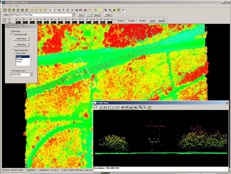
The Data Manager allows GIS production shops to increase the number of manual editing and quality control seats without incurring the costs of additional full Production Manager licenses.
End User LiDAR Exploitation Solution
For geospatial service providers that utilize the VG4D Suite for the production of the LiDAR project deliverables, now the production database can be included with project components to add value for their customers. Data Manager is the software solution that enables customers to perform internal quality control tasks, access, view and exploit not only the data contained in the LAS files themselves but also the project production database.In addition to making internal quality control tasks easier with the added ability to perform in-line editing functions in a single application, this streamlined tool enables engineers, planners, and other GIS users to be able to view and select specific classes and boundaries for re-projection and export to other formats for input into customer's industry specific applications.
Product Features
>Stand-alone; no 3rd party software required>Create LSF datasets rapidly and easily using existing imagery to attribute LiDAR data with spectral values
>LAS 1.1 and 1.2 compliant
>Real-time tracking and reporting of the production process
Tool Box
>LSF - LiDAR Spectral Fusion - LiDAR points attributed with spectral band information>Import
ASCII
LAS
BIN
other GIS product formats
>Export
Elevation
Intensity
Contours
Shaded relief
LSF
GeoTIFF image files
LAS
ASCII
GIS formats
DXF
BIN
>Create and export 3D contours
>LAS and ASCII gridding
>LAS transformation - Adjust XYZ values, shift, scale, rotate
>Re-projection
>Breakline drape / conflation
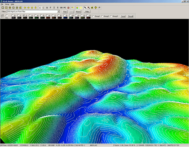
3D Visualization
>Powerful and easy-to-use 3D data viewer>Memory optimization allows visualization of very large datasets, at one time
>Profile view editing
>Integrated manual editing and reclassification tools
Linked 2D/3D view - rapidly identify and visualize tiles for display, QC or editing
>Visualization modes
Shaded relief
Elevation
Return intensity shading
Color by classification
Color by flight line
Pseudo contours
LSF
>One-button classification visualization
>Intuitive 3D rotation, panning, zoom tools, vertical exaggeration, azimuth, on-the-fly 3D TIN rendering, and on-the-fly 3D contour visualization
>GPS time, coordinate, return, intensity and filename readout by cursor location
Contouring
>Full featured toolset to create 3D breaklines by draping 2D vectors>Create cartographic quality contours - with full control over "smoothing" and minimum isolation size
Project Management
>Metrics reporting>Track time by machine
>Track time by task
>Track time by staff member
>Real-time database update during production/edit/quality control
Pricing
VG4D Data Manager is available now for purchase. Contact VGI for Network based and other portable licenses at sales@virtualgeomatics.com. . To purchase, contact our sales department at 877.VG4D WIN ext 111 (877.844.3946), or email sales@virtualgeomatics.com.Download Data Sheets VG4D Data Manager Data Sheet
