


VG4D Viewer
Powerful 3D Viewer
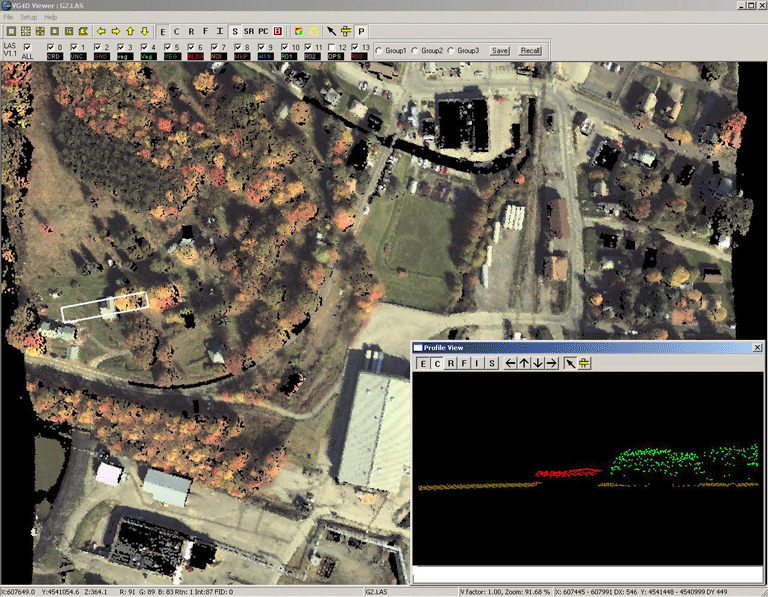
Virtual Geomatics' free, easy-to-use, 3D, fully interactive, LiDAR viewing tool. View very large datasets (whole counties) turning on and off classes, TIN on-the-fly capability and intuitive 3D rotation allows users to view the data from any angle.
3D Visualization
>Powerful and easy-to-use 3D data viewer
>Rapidly visualize point cloud data for display
>Profile / cross-section view
>One-button classification visualization
>Visualization modes include:
Shaded relief
Elevation
Return
Intensity shading
Color by classification
Color by flight line
Pseudo contours
LSF - LiDAR Spectral Fusion
>Intuitive 3D rotation
Panning
Zoom
Vertical exaggeration
Azimuth
>On-the-fly TIN rendering
>On-the-fly 3D contour visualization
>GPS time, coordinate, return, intensity and filename readout by cursor location
>Stand-alone; no 3rd party software required
>Save high resolution screen shots
>LAS 1.1 and 1.2 compliant
